Photogrammetry is the science of making measurements from photographs. The output of photogrammetry is typically a map, drawing, measurement, or a 3D model of some real-world object or scene. Many of the maps we use today are created with Photogrammetry.
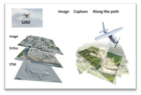
In the field of photogrammetry imagery from Unmanned Aerial Vehicles (UAV's ) and Satellites are used. Our expertise lies in processing from both platforms based on our customer's requirements.
 UAV's For Mapping
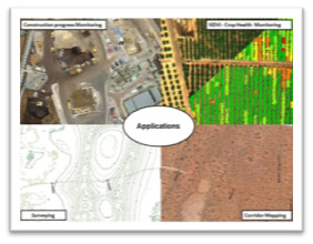
UAV system, equipped with a high resolution camera and GPS autopilot system, one can deliver a wide array of custom aerial imagery data products within days. The ability to produce high quality and meaningful data deliverables and analysis is equally as important as the flights themselves.
Photogrammetry
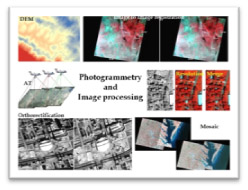
Image Processing